
Buller-Howitt Alpine Area Outdoor Recreation Guide (2nd Edition) by Spatial Vision (2013)
| Australia region | Victoria |
|---|---|
| Barcode | 9780648337621 |
| ISBN | 9780987185662 |
| Format | Maps |
| Publisher | Spatial Vision |
| Retail express code | 151985 |
| Size | 135 x 250 x 5mm |
| Weight (g) | 130 g |
Product description
The Victorian Alps comprise of countless mountain ranges which fan out finger-like from the Great Dividing Range.
The Alps cover a variety of geographic and geological features, from beautiful peaks, serene mountain valleys, wild ridges and the highest summits in the state.
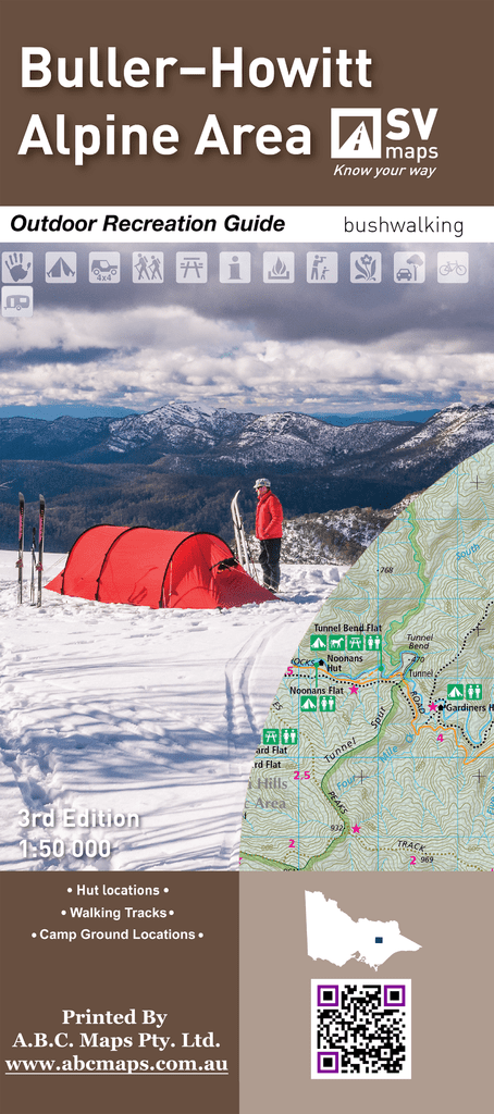
This topographic map and guide in the scale of 1:50 000 covers Mt Buller, Mt Stirling, Mt Howitt and Wonnangatta Station making this ideal for Bushwalking, Cross Country ...
Read More
![]()
The Victorian Alps comprise of countless mountain ranges which fan out finger-like from the Great Dividing Range.
The Alps cover a variety of geographic and geological features, from beautiful peaks, serene mountain valleys, wild ridges and the highest summits in the state.
This topographic map and guide in the scale of 1:50 000 covers Mt Buller, Mt Stirling, Mt Howitt and Wonnangatta Station making this ideal for Bushwalking, Cross Country Skiing, mountain biking and car touring.
This recreation guide was developed in consultation with Parks Victoria and includes touring information by Glenn van der Knijff.
This is a one sided print on demand map that now includes all relevant information from the original reverse side of the map on the main side. This includes numbered walks, visitor information parks etc. None of the imaging that was on the original reverse side is included.
Show Less| Australia region | Victoria |
|---|---|
| Barcode | 9780648337621 |
| Isbn | 9780987185662 |
| Format | Maps |
| Publisher | Spatial Vision |
| Retail express code | 151985 |
| Size | 135 x 250 x 5mm |
| Weight (g) | 130 g |


