

Central America Wall Map by National Geographic (2016)
| Barcode | 9780792292890 |
|---|---|
| ISBN | 9780792292890 |
| Format | Maps |
| Publisher | National Geographic |
| Size | 730 x 570 mm |
| Weight (g) | 300 g |
Product description
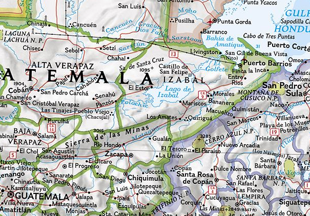
National Geographic's detailed political wall map of Central America takes an up-close look at the countries of this region. Detail includes political boundaries, place names, rivers and waterways, major highways and roads, parks and preserves, and more.
National Geographic is a renowned authority in cartography. For 120 years the Society's maps have helped spread geographic knowledge around the globe. A vast database allows National Geographic to combine the latest data gained ...
Read More
![]()
National Geographic's detailed political wall map of Central America takes an up-close look at the countries of this region. Detail includes political boundaries, place names, rivers and waterways, major highways and roads, parks and preserves, and more.
National Geographic is a renowned authority in cartography. For 120 years the Society's maps have helped spread geographic knowledge around the globe. A vast database allows National Geographic to combine the latest data gained by space-age technology with innovative digital mapping techniques to create state-of-the-art political, physical, and thematic maps. The Society's meticulous research and attention to detail have established a standard of achievement that is unparalleled.
Show LessGloss Laminate
Gloss laminate makes colours look more vibrant and stand out more, but is quite shiny (reflective). If you’re planning on using a marker of any sort, this is a better choice because it’s easier to clean. Your print will be fully encapsulated (so laminated on both sides) in durable 80 micron laminate and will last you a lot longer than plain paper.
Matte Laminate
Matte laminate has a smooth, non-reflective, very classy looking surface. I wouldn’t say it dulls colours, but it doesn’t make them ‘pop’ (I hate that I just used that word) in the way that gloss does. Matte can be drawn on with pencil (and erased), but is harder to clean if you use markers. Your print will be fully encapsulated (so laminated on both sides) in durable 80 micron laminate and will last you a lot longer than plain paper.
Canvas
Everything looks better on canvas! Something about the texture really makes prints look wonderful. It is quite expensive though. We use a very high quality 340gsm artistic matte canvas. Your canvas print will come rolled with a roughly 50mm white border to allow you to have it stretched or mounted however you wish.
| Barcode | 9780792292890 |
|---|---|
| Isbn | 9780792292890 |
| Format | Maps |
| Publisher | National Geographic |
| Size | 730 x 570 mm |
| Weight (g) | 300 g |


