
Essential Guide to Driving the Strzelecki Track

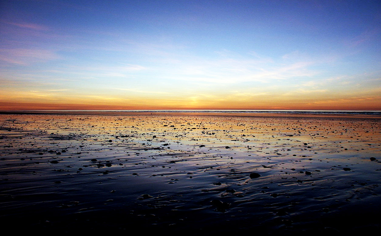 If crossing a desert in your 4WD is on your bucket list then you should definitely consider the Strzelecki Track. It’s easily accessible for those living in the southern and eastern states of Australia and can be completed in just a few days of easy driving thanks to good road conditions and limited passing traffic. The track’s interesting history and sights make for some great sightseeing in the arid landscape along this dusty dirt track.
Strzelecki Track Facts
Where is it: Lyndhurst in the middle of South Australia to Innamincka, 821 km north east of Adelaide.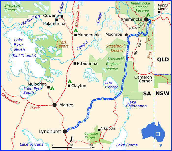 Image courtesy of Summerdrought from Wikimedia Commons
History of the Strzelecki Track
The Strzelecki track was created by cattle thief Harry Readford in 1870, while moving 1,000 cattle south from Queensland. While he was found guilty of stealing the cattle, the judge was so impressed by his determination and service to future pastoralists by creating the track that he couldn’t convict him. Readford went on to be a great cattle drover. The track and desert are named after Polish explorer, Sir Paul Edmund de Strzelecki. The explorer and scientist arrived in Australia in 1839 to complete a geological survey across New South Wales and the Australian Alps. In 1845 back in London he published his book Physical Description of New South Wales and Van Diemen’s Land which gained him the founder’s medal the Royal Geographical Society.
Driving the Strzelecki Track
While the track starts at Lyndhurst, you can begin at Leigh Creek and pass through the Vulkathunha-Gammon National Park and Flinders Ranges. Visit Wilpena Round, the natural amphitheatre and St Mary's Peak, the tallest peak of the range. Image courtesy of Kdliss from Wikimedia Commons
 Image courtesy of Caravan On Tour
 The Dingo Fence, built in the 1880s, also crosses through the Strzelecki Desert. The 5,600-kilometre fence is one of the longest man-made structures in the world. Tourists also come to see the ‘Jump Ups’ which are a welcome sight from the otherwise flat terrain. A succession of flat-top ridges and granite outcrops, they are the remnants of an ancient mountain range. Back on the track and you come across the closed town of Moomba and its gas and oil fields where gas is piped to Sydney, Adelaide and Brisbane. The last part of the track leads to Innamincka Regional Reserve, the Burke and Wills Dig tree and other historic sites, permanent water at Coongie Lakes, King’s Marker and Aboriginal culture. Fishing, boating and canoeing are available in the Reserve.
Planning, Equipment and Fuel
Before driving the Strzelecki Track, plan ahead to be self-sufficient for the entire trip. Its remote location means you need to bring your own water, food and fuel. You can refuel at Lyndhurst, Copley, Leigh Creek and Innamincka. Temperatures in this part of the world often drop below zero overnight during winter so take warm clothing and bedding. In summer, temperatures in the high 40s are not uncommon - it’s a desert so take plenty of drinking water all year round! Mosquitoes in the the northern parts of South Australia particularly near water holes can carry serious diseases such as Ross River virus and Barmah Forest virus which can cause joint pain, rash, fever, and muscle pain. The flies can also be thick along the track so you may need a net to keep them off your face. Cover your skin with loose-fitting clothing and apply insect repellent. Take extra precautions against mosquitoes while camping along the Strzelecki Track. If you are leaving the track, consider taking an EPIRB in case you experience car trouble and need to call for help. Image courtesy of Kdliss from Wikimedia Commons
Strzelecki Track Road Conditions
Most of the track is suitable for 4WD enthusiasts of all skill levels except around Arkaroola where the surface is loose, particularly in dry creeks. It’s best to take more than one spare tyre on the trip. The track is well maintained so that road trains can access the Moomba and Gidgealpa oil and gas fields. However, the road conditions can become impassable after heavy rains so check the forecast before you go. The Desert Parks Bulletin gives details of track conditions for the Innamincka region. Pooled water, washout and corrugation locations are noted in the bulletin. The South Australian government is working with Infrastructure Australia on a project to widen the track to a two-lane sealed road with floodway works and a bridge over the Strzelecki Creek. The sealed road will mean better reliability, faster travel times and reduced transport operating costs for trucks. The project will include the Strzelecki Track and Adventure Way, 26km of road linking Innamincka to the Queensland border. News of sealing the track has disappointed many 4WD enthusiasts since its announcement in 2015 so if it’s on your bucket list you should do this drive sooner rather than later.
Permits and Fees
A Desert Parks Pass allows you access to Innamincka Regional Reserve and another six desert parks in South Australia otherwise you can buy an individual pass for Innamincka. The pass provides 12 months unlimited vehicle entry and camping.Strzelecki Track Maps and Guide Books
When driving in remote areas like this we always recommend you plan ahead and take a good quality map or off road GPS. You can find an online map of the Strzelecki Track here. We can recommend the following maps and guides as well: Strzelecki Track Outback Travellers Guide Birdsville and Strzelecki Tracks Hema Great Desert Tracks Eastern SheetFeatured collection


Categories:
4WD
Australia
News
Posted on: Oct 11, 2018


Comments