Tanami Track – Your Guide to Driving This Off-Road Gem

Image courtesy of Stephan Ridgway via Flickr
Tanami Track borders the Central Desert and traverses two states – WA and NT. It’s known as a shortcut from Halls Creek through the Kimberley and central Australia to Alice Springs, an alternative route to Stuart Highway. While driving through desert country may not sound too appealing, the jewel in the track’s crown is Wolfe Creek Crater, made famous by the horror film, Wolf Creek. Best you don’t watch it before travelling.
Tanami Track Overview
Locations: Halls Creek to Alice Springs, Alice Springs to Halls Creek and Alice Springs to Broome via Tanami Track are all popular routes.
Length of Track: 1,050 kilometres.
Best Time to Travel: Avoid the summer months because daytime temperatures can be as high as 45 plus.
Time Required to Travel: Two to three days.
Suitable for: 2WD during the dry season or 4WD during the wet season. Suitable for towing an off-road camper trailer.
Camping: Find a cleared area to set up camp for the night. Beware some areas require a permit to stay overnight.
Supplies: It’s best to be self-sufficient for water and food for the trip as supplies may not be available. Bore water tanks may be dry or contain non potable water. Take more water than you think you will need, it’s dry country.

Image courtesy of Harclade via Flickr
Suggested Itinerary
It’s up to you how fast or slow you want to drive the track but you will need at least two to three days to enjoy the trip and take in the sights.
Leave Halls Creek on the Great Northern Highway for the first 16 km before taking the Tanami Track to head to Wolfe Creek Crater, 170 km away.
After walking up the crater’s rim and having a bite to eat, jump back in the car and head to the first fuel stop at Billiluna community. Here the Canning Stock Route intercepts the Tanami Track. The Balgo community is 35 km south off the Tanami Track and also has fuel for sale. Be sure to call ahead before entering.
After Billilunathe the track heads east to the Lajamanu community, before crossing over the Western Australian border into the Northern Territory.

Image courtesy of Harclade via Flickr
Next stop is the Renahans Bore Rest Area for overnight camping. The Yuendumu community is a short drive from the rest area. It is a fuel stop but, if there is no fuel available, Tilmouth Well Roadhouse is another 100 km down the road with reliable fuel supplies.
Alice Springs is another 200 kilometres further on at the end of the track.
Things to See & Do Along The Track
Much of the track is flat desert landscape covered in spinifex but there are a few points of interest along the way.
Wolfe Creek Crater
The WA side of the track is the Wolfe Creek Crater caused by a meteorite slamming into the earth’s surface approximately 300,000 years ago. Estimated to weigh 50,000 tonnes, the meteorite travelled at 15 kilometres a second. Europeans discovered the 880-metre spectacular circular crater in 1947 during an aerial survey. However, the original custodians had already named the crater Kandimalal. The crater is named after Robert Wolfe, a prospector and storekeeper.

Image courtesy of Stephan Ridgway via Flickr
Get a close-up view of the crater by taking the 200 metre return walk from the carpark to the rim. The crater is popular among photographers and nature lovers. Look for the Major Mitchell cockatoos enjoying the wattle seeds from plants growing on the crater floor. You may see small mammals at dawn and dusk. Don’t climb down the 50-60 metre wall to reach the crater floor. It’s steep with loose rocks and considered too dangerous to climb.
Located in the Wolfe Creek National Park, the gravel access road to the crater may be closed during the wet season. To fully appreciate the size and beauty of the crater, some visitors take a scenic flight from Halls Creek.
China Wall
China Wall is a limestone formation with a vein of white quartz running through that resembles the Great Wall. The quartz is up to 6 metres higher than the surrounding ground. China Wall is only 6 km from Halls Creek off the Duncan Highway.
Warlayirti Artists Aboriginal Corporation
Considered one of the most remote art galleries in the world, The Balgo Aboriginal Community showcases the work of 300 Indigenous artists from the local communities. Call in to check out the range of art that includes paintings, etchings, photography, film and music.
Flora and Fauna
Tanami Track runs through the Tanami Desert. The 184,000 square kilometres of desert landscape changes as you travel through. The section closest to the Kimberley is rocky and hilly terrain, the middle is flatter and the south has small ranges. The landscape changes from sandy plains to spinifex, low acacias and grevillea.

Image courtesy of Fraser Mummery via Flickr
The Tanami Desert is Australia’s most northern desert. It receives an impressive average annual rainfall of 400 ml. Take a short detour to Lake Gregory and Lake Stretch accessible via the northern end of the Canning Stock Route. During the wet season the wetlands fill to 10 metres deep, attracting 1000,000 water birds. Stay overnight at one of three campsites to experience the sunset and sunrise views over the lake and its bird life.
Despite the harshness of Tanami Track countryside, there’s still plenty of wildlife to keep the trip interesting. Some endangered species call the desert home including the rufous-hare wallaby and the bilby. A few species are only found in the Tanami area including the Tanami Toadlet frog and a few plants.
However, the wildlife and vegetation is under threat from a range of wild and feral animals including cats, foxes, rabbits, camels and donkeys. Overgrazing from domestic cattle also places pressure on the landscape.
You may come across some inquisitive dingoes on your travels. A study revealed the Tanami dingoes are some of the purest in Australia with 90% of DNA samples testing pure.
The wedge tail eagle never fails to impress soaring in the sky or feeding on a roadside carcass. The females are larger than males and have an incredible wingspan of over 1.8 metres. Cars don’t scare the wedge tails so don’t assume they will fly off when you approach. Always expect the unexpected when driving in the area.
Tanami Track Road Conditions
Like plenty of tracks around Australia, road conditions vary in parts. It can depend on when the road was last graded, the weather and the time of year.

Image courtesy of Stephan Ridgway via Flickr
Tanami Road is in better condition than many remote tracks because of the nearby Tanami and Granite mines. They are some of the biggest gold mines in Australia and the mining companies help maintain the road. Some small sections are sealed so it can hardly be called a track along the bitumen parts! The mines’ road trains use the roads so remember to pull over as much as possible and stop to let them pass safely.
The track is prone to flooding and damage after heavy rains during the wet season and may be closed if flooding is severe. In 2019, the Australian Government announced an upgrade to the Tanami Road and nearby Stuart Highway and Browns Range Road to improve reliability of the roads, particularly during the wet season. The Government recognises the importance of the Alice Springs to Halls Creek corridor as it supports the mining, agriculture and tourism industries.
Fuel Stops on the Tanami Track
In the far north of Australia, the distance between fuel stops can be (uncomfortably) long. Fuel availability along the Tanami Track is no different - one 600 kilometre stretch has no fuel stops at all. Always know where your next fuel stop is and check you will have enough taking into account road conditions and poor fuel economy.
If you are towing, you’ve deflated your tyres or are driving in high range, this will impact your fuel economy. It’s always best to be prepared - fill enough jerry cans so you don’t run out.

As well as the towns of Halls Creek and Alice Springs, you can fill up the car and jerry cans at the Billiluna fuel and community stop, TilmouthWell Roadhouse and Yuendumu fuel and community stop.
Price of fuel along the track varies but be prepared to pay a hefty premium in some locations. Some fuel stops are 24 hour self-serve while others are open reduced hours. Don’t rely entirely on credit or debit cards while travelling in remote locations. If you don’t want to carry a wallet full of cash, hide enough money in your camper to fill the tank in case EFTPOS facilities are down. Otherwise, you might find yourself stranded at a fuel stop waiting for card facilities to come online.
Camping Spots
Some parts of the track allow you to camp wherever you like, but other sections border communities that require you to have a permit to stay overnight. The Renahans Bore Rest Area is also an overnight campsite. There is a picnic table, bin and water tank but no other facilities. The Wolfe Creek National Park has a no-cost camping area with clearings and toilets.
Otherwise, pull off the track into a clearing and set up camp. Ideally work out which way the wind is blowing so the dust from passing road trains doesn’t blanket your campsite.
Communications
There is mobile reception at three Aboriginal communities along the track. The Billiluna community has Optus while Balgo and Yuendumu use Telstra. You don’t need a permit to go into the communities to use your phone or buy supplies but you will need one to stay overnight.
While there is plenty of passing traffic on the track, it is good practice to travel with a satellite phone or a personal beacon just in case you need emergency assistance. Don’t rely on passers-by, have all your own recovery gear and know how to use it.

Tanami Track FAQs & Resources
How long is the Tanami Track?
Around 1,050 km
Where is the Tanami Desert located?
The Tanami Desert is north-west of Alice Springs in the Northern Territory.
How big is the Tanami Desert?
The Tanami desert is the third biggest desert in Australia, covering an area of more than 184,000 km2.
What animals live in the Tanami Desert?
Native animals in the Tanami Desert include marsupials like the Bilby and Wallabies, birds and reptiles. There are also many introduced species such as foxes, camels, feral cats and donkeys.
Is the Tanami Track Sealed?
No, the track is sealed in some parts and corrugated in others.
What time of year is the Tanami Track most likely to close?
In tropical areas of Australia, the wet season is during the summer months. Flooding rain is most likely between October and March.
What is the temperature in summer?
During the day the average maximum daytime temperatures are around 36- 38°C but can be much hotter while the nights average 20 - 22°C.
What is the temperature in winter?
Winter day time temperatures are far milder with an average of 25°C and at night the temperature can drop below 10°C with frosts.
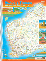
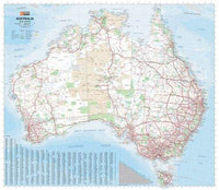
Before you set out, check on road conditions in case part of the track has been closed. Take a paper Tanami Track map with you in case you can’t access your electronic maps.
Important Contact Details
Halls Creek Visitors Information Centre
71 Thomas St
Halls Creek
Ph (08) 9168 6007
Parks and Wildlife Service (WA)
089168 4200
Balgo Community
Ph (08) 9168 8900 before entry
Alice Springs Visitor Information Centre
Ph: (08) 8952 5800

You should pick up a copy of the Tanami Road Outback Travellers Guide before you set off. This will help you find everything you need along the track, pointing out road conditions and specific locations. A couple of maps might also be useful - Westprint's Tanami Road or Hema's Great Desert Tracks Central Sheet. Tragedy Track is worth a read to learn about some of the rich history of the track.
If you are after a particular book, map or a recommendation, don’t hesitate to ask the expert staff at The Chart & Map Shop by calling (08) 9335 8665 or contact us online.
View all 4WD camping books.


Comments