

Map of the European Inland Waterways by EuroMapping (2012)
| ISBN | n/a |
|---|---|
| Format | Maps |
| Publisher | EuroMapping |
| Retail express code | 149902 |
| Size | 890 x 700 x 1mm |
| Weight (g) | 250 g |
Product description
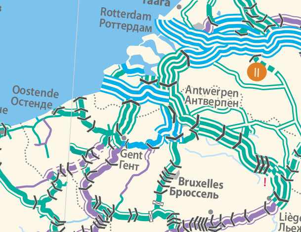
A flat map showing the inland waterways throughout Europe. The map shows free flowing rivers, canalized rivers, canals, locks with indication of their total number, when applicable, ship lifts (inclined plane or water slope) and dams with no locks.
It also tells you minimum heights under bridges and maximum draught.
The legend is in English, French and Russian.
Read MoreA flat map showing the inland waterways throughout Europe. The map shows free flowing rivers, canalized rivers, canals, locks with indication of their total number, when applicable, ship lifts (inclined plane or water slope) and dams with no locks.
It also tells you minimum heights under bridges and maximum draught.
The legend is in English, French and Russian.
Show Less| Isbn | n/a |
|---|---|
| Format | Maps |
| Publisher | EuroMapping |
| Retail express code | 149902 |
| Size | 890 x 700 x 1mm |
| Weight (g) | 250 g |


