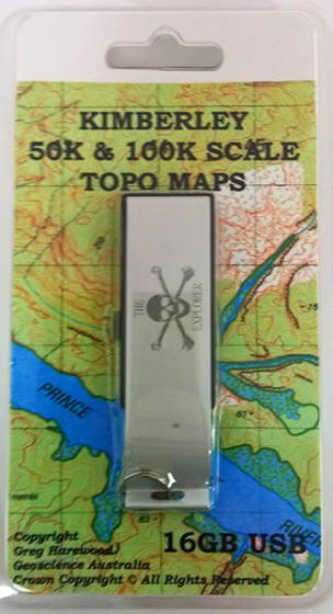
Kimberley 50K & 100K Scale Topo Maps USB (2nd Edition)
| Australia region | Western Australia |
|---|---|
| Barcode | 9321438102328 |
| ISBN | 9321438102328 |
| Format | Maps |
| Publisher | Greg Harewood |
| Size | 85 x 135 x 10mm |
| Weight (g) | 95 g |
Product description
The 16GB USB contains 438 digital scans of the Defence Departments 1:50,000 topographical map series that covers most of the Kimberley region of north-west W.A, including major offshore islands and reefs. In addition, a 100K scale mosaic is included and represents a combined image of all of Geoscience Australia's 100K topographical maps of the region.
The digital maps and other data supplied with this product are primarily designed for users of ...
Read More
The 16GB USB contains 438 digital scans of the Defence Departments 1:50,000 topographical map series that covers most of the Kimberley region of north-west W.A, including major offshore islands and reefs. In addition, a 100K scale mosaic is included and represents a combined image of all of Geoscience Australia's 100K topographical maps of the region.
The digital maps and other data supplied with this product are primarily designed for users of OziExplorer GPS mapping software (not included) however the maps are also suitable for use with a wide range of other map viewing/gps mapping software or printing. Please check compatibility with your preferred gps/mapping software before purchase (Note: some other image formats are available upon request).
The maps supplied represent digital scans of the original paper maps (200dpi). The 50K map sheets are supplied in OZF3 and ECW format while the 100K mosaic is supplied in ECW format only. OZF3 images can only be used with the various versions of OziExplorer (Windows PC, Android and Windows CE (including the Hema Navigator). The ECW format image files can be used with OziExplorer but also a wide variety of other navigational and GIS programs such as TrackRanger, TwoNav, ArcView, MapInfo and Global Mapper.
Each map sheet generally covers an area of 15' longitude by 15' latitude which corresponds to approximately 25km x 25km. Some combined sheets cover a slightly larger area.
The maps are the most detailed available in digital raster format over this entire area and show all significant natural features (lakes, swamps, rivers, creeks, hills, coastal features etc.) along with cultural features (tracks, roads, highways, towns, dams etc. ) present at the time the data was collected for use to draft the maps. Relief on the 50K maps is portrayed by contours (10m intervals) and spot heights in metres; populated places symbolised; roads classified by surface and width; railways shown; drainage and vegetation symbolised; foreshore and offshore features shown.
This USB comes with ER VIEWER (by Intergraph), a free desktop image viewer that allows you to open and view the supplied ECW map files on your computer. The program provides a coordinate readout in either decimal degrees to two decimal places (for maps calibrated using Latitude and Longitude) or in metres to two decimal places (for maps calibrated in UTM). Distance measurement is also available for UTM projected maps.
For a more accurate co-ordinate readout, and access to features such as moving map, track and waypoint creation, a compatible map viewing software such as OziExplorer or TrackRanger is required. These programs are not included on the USB and must be obtained separately, possibly at additional cost. It should be noted that free demo versions of some programs are available. Some of these can be used to at least view the maps. See individual software maker's websites for details.
Show Less| Australia region | Western Australia |
|---|---|
| Barcode | 9321438102328 |
| Isbn | 9321438102328 |
| Format | Maps |
| Publisher | Greg Harewood |
| Size | 85 x 135 x 10mm |
| Weight (g) | 95 g |


