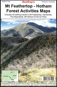
Mt Feathertop-Hotham Forest Activities Road Map (2nd Edition) by Rooftop Maps (2009)
| Australia region | Victoria |
|---|---|
| Barcode | 718122171095 |
| ISBN | 718122171095 |
| Format | Maps |
| Publisher | Rooftop Maps |
| Size | 140 x 195 x 2mm |
| Weight (g) | 100 g |
Product description
The Mt Feathertop-Hotham Forest Activities Map has mapping at 1:50,000 that covers Mount Feathertop and Mt Hotham that is ideal for bushwalking.
This map includes:
- Notes
- Places of interest
- Ideal for outdoor recreational activities
This 4WD and adventure guide to the Australian Alps around the Hotham and Feathertop regions including Mount Feathertop, Harrietville, Upper West Kiewa River, Mount Hotham, Dibbins Hut, and an inset map for walks near Dinner Plain.
Read MoreThe Mt Feathertop-Hotham Forest Activities Map has mapping at 1:50,000 that covers Mount Feathertop and Mt Hotham that is ideal for bushwalking.
This map includes:
- Notes
- Places of interest
- Ideal for outdoor recreational activities
This 4WD and adventure guide to the Australian Alps around the Hotham and Feathertop regions including Mount Feathertop, Harrietville, Upper West Kiewa River, Mount Hotham, Dibbins Hut, and an inset map for walks near Dinner Plain.
Show Less| Australia region | Victoria |
|---|---|
| Barcode | 718122171095 |
| Isbn | 718122171095 |
| Format | Maps |
| Publisher | Rooftop Maps |
| Size | 140 x 195 x 2mm |
| Weight (g) | 100 g |


