
Canning Stock Route: A Guide to Driving This Iconic Track

The Canning Stock Route is an icon in Australian 4WD culture. It’s the longest stock route in the world - an impressive 1,800 kilometres winding through unique terrain of the Gibson Desert, Little Sandy Desert and Great Sandy Desert. It’s the remote, harsh countryside that attracts seasoned 4WD enthusiasts looking to tick it off their bucket list.
Canning Stock Route Overview
Location: Wiluna to Halls Creek, WA
Length of Track: 1,800 kilometres
Best Time to Access: May – August. It’s best to avoid the summer months because daytime temperatures can reach over 45 degrees however night time temperatures in winter can drop below zero.
Time Required to Travel: Allow two to three weeks to enjoy the drive
Suitable for: 4WD
Camping: Find a cleared area to set up camp for the night
Supplies: It’s best to be self-sufficient for water and food for the trip as supplies may not be available. Take more water than you think you will need, it’s dry country.
History of the Canning Stock Route
The track is named after Alfred Wernam Canning who was commissioned to survey a stock route in 1906. The party travelled north from Wiluna to Halls in 1906 and 1907 with Aboriginal guides showing them water sources.
Canning and his team of 30 well sinkers surveyed the route and built or found 54 watering spots – 51 wells still remain today. The first cattle drive began soon after in 1911. Twenty years later Canning supervised the reconditioning of the wells. The wells are spaced one day’s walk apart to keep cattle alive while the stockmen drove them to market. It wasn’t always called Canning Stock Route. Before the survey, it was known as the Sturt Creek-Wiluna Stock Route or Wiluna-Sturt Stock Route. It was informally called Canning Stock Route from 1910 but wasn’t officially named until 1967. Alfred Wernam Canning died in 1936. The CSR lost favour when the Port of Wyndham started exporting cattle. The port is still used today for exports.
Getting There
To get on to the Canning Stock Route use Tanami Road taking the Billiluna turnoff, approximately 42 kilometres south of the Wolfe Creek Crater.
Travel Times and Track Conditions
It’s best to avoid the route in summer months because of high temperatures. The heat poses additional risks to vehicles and travellers in desert country. There are also fewer people on the road in summer so if you need assistance, you could be waiting much longer for a passing vehicle. Summer is also the wet season in northern Australia so after heavy rain, the track can turn into a quagmire. Always check on road conditions before setting out in these parts.
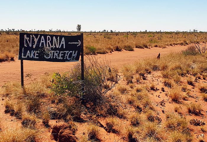
Image courtesy of Ian Cochrane via flickr
While travelling in winter means pleasant day time temperatures in the teens and early 20s, night time temperatures can be in the single digits and drop as low as zero. Be prepared with plenty of warm clothing and bedding. While the track is predominantly sand, there are rocky sections, washouts and an incredible 900 sand dunes to navigate over. Because of the high dunes, all vehicles on the track are required to use a sand flag. The flag warns oncoming traffic before the vehicle is in view. A further safety precaution is to use Channel 40 to warn other travellers when you are approaching a high sand dune.
Things to See
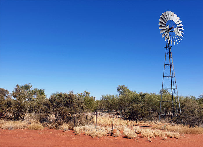
Despite the Canning Stock Route traversing three deserts, the landscape is anything but boring. It changes constantly on the route – dusty sandy plains, natural waterholes, pink lakes, salt lakes, spinifex, big eucalyptus trees and a stunning wildflower display in August and September. The wildlife includes bees and wasps particularly around the wells, feral camels, and the thorny devil to name a few.
Driving Experience
You will need plenty of 4WD experience under your belt before tackling the Canning Stock Route. Your vehicle needs to be able to handle the harsh conditions, constant dunes and long distance. It’s best to do the track in convoy with at least one other vehicle so you can help each other out with recovery, if needed.
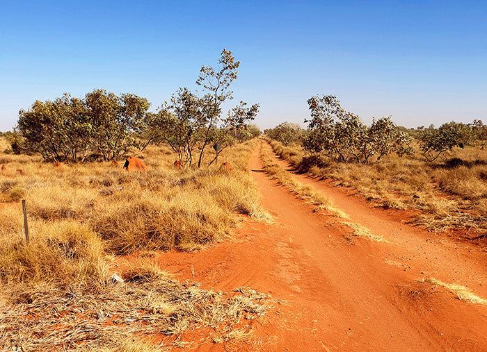
Image courtesy of Ian Cochrane via flickr
You need to be able to cope with constant corrugations on the track. They can be deep, bone shaking corrugations that last all day. Some travellers spend the day driving with the speedometer under 30km/h. Driving up sand dunes is less bumpy than the trip down the other side. Reducing the car’s tyre pressure helps get over the dunes and soft sand patches.
Permits
You won’t stay on the historic canning stock route throughout your entire trip. There are times when you need to leave the original track and take 4WD tracks through native title land. The track runs through 5 native title areas, Tjurabalan, Martu, Birriliburu and Wiluna. Some parts of the track require travel permits. For sections between wells 5 and 15 and 40 to 51, you obtain permits via the Canning Stock Route Visitor Permit System. If you are travelling between wells 16 to 39, the Australian National Four Wheel Drive Council has permits for this area. The permits give you information on where you can travel and which wells you can visit.
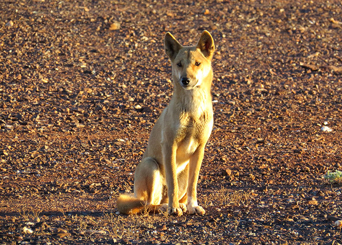
Image courtesy of Graham Winterflood via flickr
If you are staying overnight on the nearby Tanami Track on your way to Canning, you may need a permit here as most of this land is owned by its traditional owners, too. The permit funds are used to maintain the route as well as the protection of environmental, cultural and heritage values of the area.
Fuel, Water and Supplies
Supplies along the Canning Stock Route are limited so planning ahead is vital. It’s recommended to make an inventory list of supplies to be well prepared. Before travelling you should contact the local visitor centre for up-to-date track information and weather conditions.
Fuel
The fuel dump at Well 23 is organised by the Capricorn Roadhouse at Newman. Kunawarriji, 1,040 km from Wiluna, has fuel, water and a well-stocked shop to refill supplies. Take a jiggler to get fuel out of the drums and into your vehicle. The Parngurr community, 70 km from the Georgia Bore on the Talawana Track, also has fuel.
Supplies
While it’s best to take enough food to last the trip, there are shops along the way. If you are driving south to north, do your main shop at Kalgoorlie as the Wiluna shop is small. The Kunawarriji community has a small shop with fresh produce, the remote Billiluna community is the same while Halls Creek and Fitzroy Crossing have supermarkets.
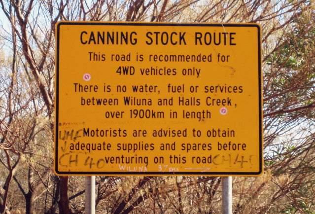
Image courtesy of Calistemon via Wikimedia Commons
You can find some passing traffic along the track, but it is a good idea to travel with a satellite phone or a personal beacon just in case you need emergency assistance. Don’t rely on passers-by, you should have your own recovery gear and know how to use it.
Wells
The condition of the 51 wells varies greatly from one well to the next. Some wells are in ruins and are dry or muddy holes while other are a running water oasis that can used for showering and washing. Some of these wells have been renovated in recent years with a winch and bucket. If you intend to use well water for cooking or drinking, always boil first. Some wells have nearby toilets, fire pits, big shady eucalyptus trees and grass for camping and others have no facilities.
More Information and Canning Stock Route Maps
Before you set out, check road conditions in case part of the track has been closed. Local area authorities include the following:
Shire of Halls Creek
Billiluna
Shire of Wiluna
Western Desert Lands Aboriginal Corporation
The following are some maps, guides and resources you might find useful:
Canning Stock Route
The 4WDriver`s Guide: Canning Stock Route
Hema Great Desert Tracks Western Sheet
Work Completed, Canning
Canning Stock Route Royal Commission
A Camelman on the Canning


Comments